MICRONESIA
Learn More About
Weni Mmwaemi* — Aloha! ʻAha Moananuiākea honors the strong cultural relationships between Kānaka Maoli, Native Hawaiians, and the peoples of the diverse Micronesian world, which include shared love of our lands and waters, our peoples, our languages, and our identities. Learners of all ages and backgrounds are invited to immerse in this rich Pacific heritage and explore topics of interest at a self-directed pace. Au Wa Aerhigerhig* — Mahalo!
*This greeting is in the language of Satawalese, the native language of Mau Piailug.
Micronesia
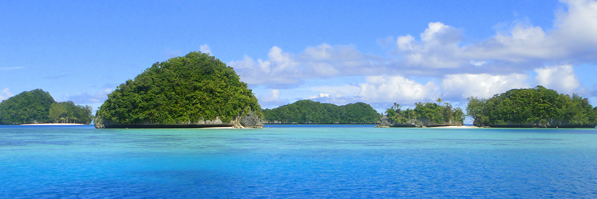
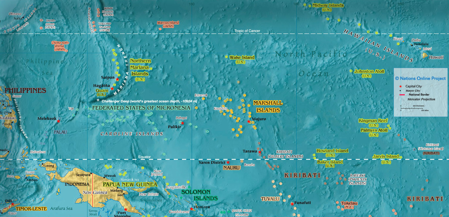
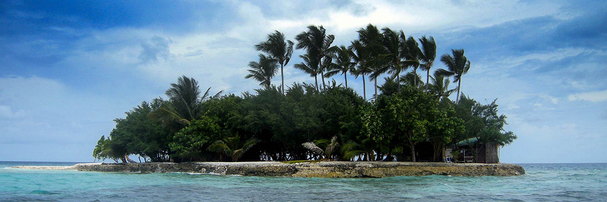
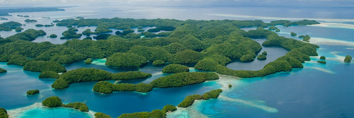
Located in the tropical marine region of the northwestern Pacific, Micronesia is a sub-region of Remote Oceania that encompasses about 2,100 islands, which in the aggregate is a mere 2,700 square kilometers of land. However, it covers an expanse of ocean spanning 2.9 million square miles (7.4 million square km) and extends across a distance of some 3,000 miles (5,000 km). Its geography is a combination of coral atolls and high volcanic islands, bordered by Palau and the Mariana Islands in the west and by the islands of the Marshalls and Kiribati in the east. Its ocean waters are home to some of the most biologically diverse marine environments in the Pacific, and with many of its islands receiving annual rainfall of 100 inches or more, Micronesia is a region rich with life.
Early settlement
The earliest known human settlement in Micronesia occurred in the western island groups — the Marianas and Palau — by Austronesian speaking voyagers from Island Southeast Asia, likely the Philippines, some 3,500 years ago. Remarkably, the maritime technology they employed distinguishes them as having made the very first and longest ocean crossing on the open sea, about a thousand years prior to the better-known Polynesian seafaring exploits in the central Pacific. Strong evidence for the settlement of Yap occurred about 3,000 years ago and is directly linked to the Admiralty Islands in the northwest Bismarck Archipelago, a gateway for initial Austronesian arrival in Melanesia from Island Southeast Asia (with genetic markers traced to Taiwan).
The more central Carolinian Islands — Lamotrek, Puluwat, and Satawal, for example — and eastern islands such as the Marshalls, Kiribati, and Nauru were settled by Austronesian speakers between 2,000–3,000 years ago largely from the region of Vanuatu and the Solomon Islands, with some periodic contact from Polynesia. The island communities of Nukuoro and Kapingamarangi today are culturally and linguistically Polynesian and are the direct descendants of migrant Polynesians who voyaged far beyond the “Triangle” and settled as anomalistic outliers within the central Carolinian group between 1000–1500 years ago. As study of this complex region continues, and discoveries shed new light on human settlement, what’s absolutely certain is that Micronesia has always been and will continue to be a place of dynamism and diversity, of oceanic ingenuity and innovation.

Regional partnership
For information on the ʻAha Moananuiākea Partnership with Micronesia, see the link below:
Micronesia Partnerships & Declarations
The Regions of Micronesia:
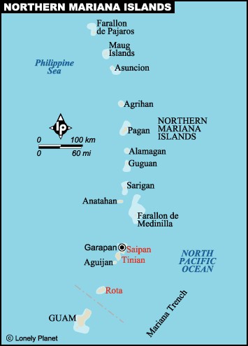
Commonwealth of the Northern Mariana Islands
The Commonwealth of the Northern Mariana Islands (CNMI) comprises 14 islands of which three are permanently inhabited: Tinian, Rota, and the capital, Saipan. As a self-governing commonwealth of the US since 1986, there are two major indigenous groups in CNMI: the Chamorro/Chamoru people who are native to the Mariana Islands, and the Carolinians who migrated from the Caroline Islands beginning in the early 19th century due to extensive devastation of their native environment from a typhoon. “Chamorro” may be a derivation of the indigenous term “chamorri,” which refers to the high caste in ancient Chamorro society. The Carolinians refer to themselves as “Remathau,” meaning “People of the Ocean” or “People of the Deep Sea.”
Chamorro researcher and Guam Museum executive director Dominica Tolentino offers the following narrative describing matrilineal lineage, and social organization in clans:
“Ancient Chamoru society is believed to be matrilineal, so the maternal line was more important for determining who one’s relatives were. The old Chamoru word for matrilineage is achafnak, meaning ‘of same birth,’ or ‘relatives from the same womb.’ In the achafnak system, a male belonged to the same descent group as his mother, his mother’s mother (grandmother), the mother’s siblings (aunts and uncles), and the mother’s sister’s (aunt) children (cousins). In addition, his children belonged to their mother’s descent group.
The mother’s line, therefore, was also the important economic and social unit, controlling land and other resources. Members of a matrilineage had privileged access to their ancestral lands and also the authority to determine who else would be able to use them. Because land was limited, it did not belong to single lineages. Instead, ancestral lands were maintained by clans.
Clans are groups of two or more families or lineages who claim descent from a common ancestor, although they cannot trace the exact genealogical links to that ancestor. Clans form when a lineage continually expands generation after generation. The lineage may grow too large for its resources, and so the lineage may split into smaller lineages which still recognize their original ancestor. A clan differs from a lineage in that the members are more dispersed, meaning they may live apart from other related lineages.”
• Guampedia
https://www.guampedia.com/micronesia-portal/#Commonwealth_of_the_Northern_Marianas_CNMI
Guampedia is a non-profit affiliate of the University of Guam, and in this Micronesia Portal, it provides general information about the island nations of Micronesia as well as resources for further reading.
http://www.cnmiartscouncil.org/
The CCAC serves to develop and foster programs that promote excellence in the arts, promote and utilize diverse artistic and cultural resources, provide quality arts experiences for its citizens and opportunities for artists, and promote and perpetuate the unique folk heritage of the Commonwealth of the Northern Mariana Islands.
https://www.youtube.com/watch?v=LmQdMsOz1hU
A two-minute video highlighting Saipan’s Indigenous Cultural Expo held in 2019.
This office’s official Facebook page provides a glimpse into the people of CNMI.
This site promotes cultural interchange and environmental sensitivity for the benefit of future generations of the people of CNMI as well as visitors. Check out the dropdown menu “The Islands” for general information on The Marianas, Saipan, Tinian, Rota, and the Northern Islands.
http://mastersoftraditionalarts.org/artists/285
Learn more about Felipe I. and Joseph K. Ruak and their work to perpetuate traditional Carolinian stick dancing in this spotlight by Documentary Arts, Inc.
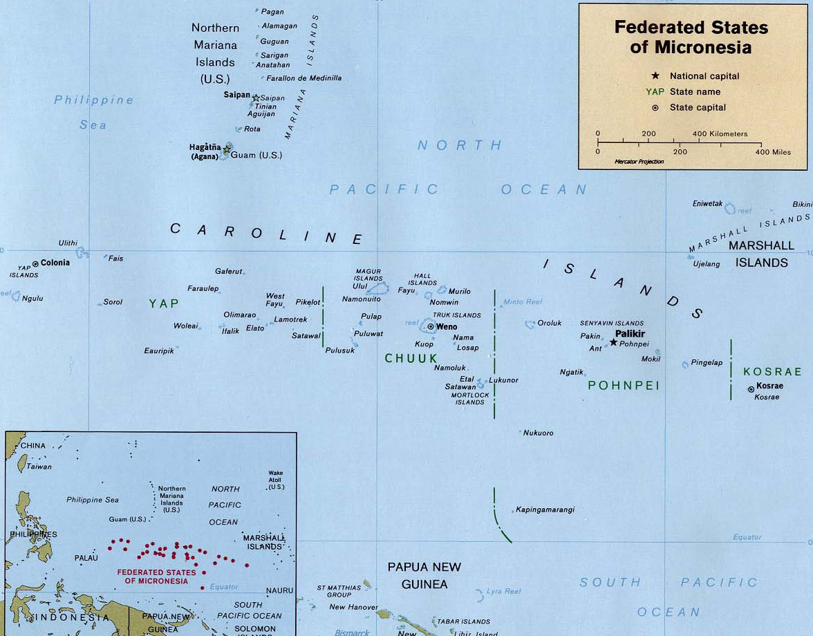
Federated States of Micronesia
The Federated States of Micronesia (FSM) is located in the archipelago of the Caroline Islands and includes roughly 600 islands and atolls. As an independent nation with a Compact of Free Association with the US since 1986, FSM is divided into four semi-autonomous and geographically distant states: Pohnpei, Chuuk, Yap, and Kosrae. Each state has its own history, culture, language, and traditions, and the people are likely to regard themselves as Yapese, Chuukese, Pohnpeian, or Kosraean, but also refer to themselves as Micronesian. The capital, Palikir, is located on Pohnpei.
Traditional leadership structure varies between the four regions. Yap has two councils of chiefs, with the paramount chiefs controlling politics and relationships between villages, including property and land issues. In Pohnpei, the paramount chiefs play a spiritual role and ensure peace among the clans and equal distribution of resources. Chuuk has lineage heads rather than paramount chiefs, and while Kosrae at one time had a structure similar to that of Pohnpei, it has since been replaced by church leaders, family leaders, and modern government leadership. Today, Christianity plays an important role in daily life in FSM.
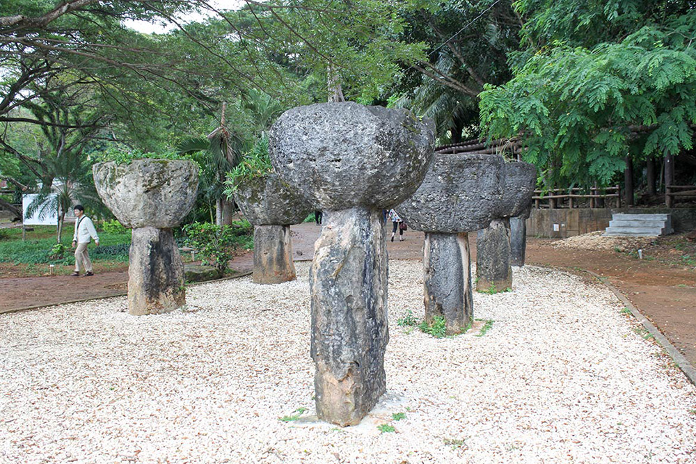
The ingenuity and complexity of these island societies can still be seen in a number of remaining heritage sites including Nan Madol, the ceremonial center of the Saudeleur dynasty on Pohnpei, and the royal tombs of Leluh on Kosrae. FSM has 17 recognized indigenous languages, but English is taught in all schools and used as a common language between different groups.
• Guampedia
https://www.guampedia.com/micronesia-portal/#Federated_States_of_Micronesia_FSM
Guampedia is a non-profit affiliate of the University of Guam, and in this Micronesia Portal, it provides general information about the island nations of Micronesia as well as resources for further reading.
https://www.youtube.com/watch?v=HfgdOR7-WwY
A 20-minute video including twelve dance performances from all four states.
https://www.youtube.com/watch?v=OkKNlsXBscI
A 25-minute video featuring dance and celebration from the island of Yap.
https://www.cwcfiinchuuk.org/index.php/cultural-preservation
The Chuuk Women’s Council seeks to reintroduce and preserve traditional Chuukese culture.
http://www.visit-micronesia.fm/about/index.html
http://www.visit-micronesia.fm/culture/index.html
This site provides general info about Yap, Chuuk, Kosrae, and Pohnpei, including overviews of each state’s geography, language, history, culture, dance, food, and more.
https://whc.unesco.org/en/list/1503
Learn more about this UNESCO World Heritage Site and its outstanding universal value and importance.
https://omniglot.com/writing/chuukese.htm
https://omniglot.com/writing/kosraean.htm
https://omniglot.com/writing/pohnpeian.htm
https://omniglot.com/writing/yapese.htm
Explore these links to Omniglot webpages featuring the four recognized regional languages of FSM, including samples of each language and background information.
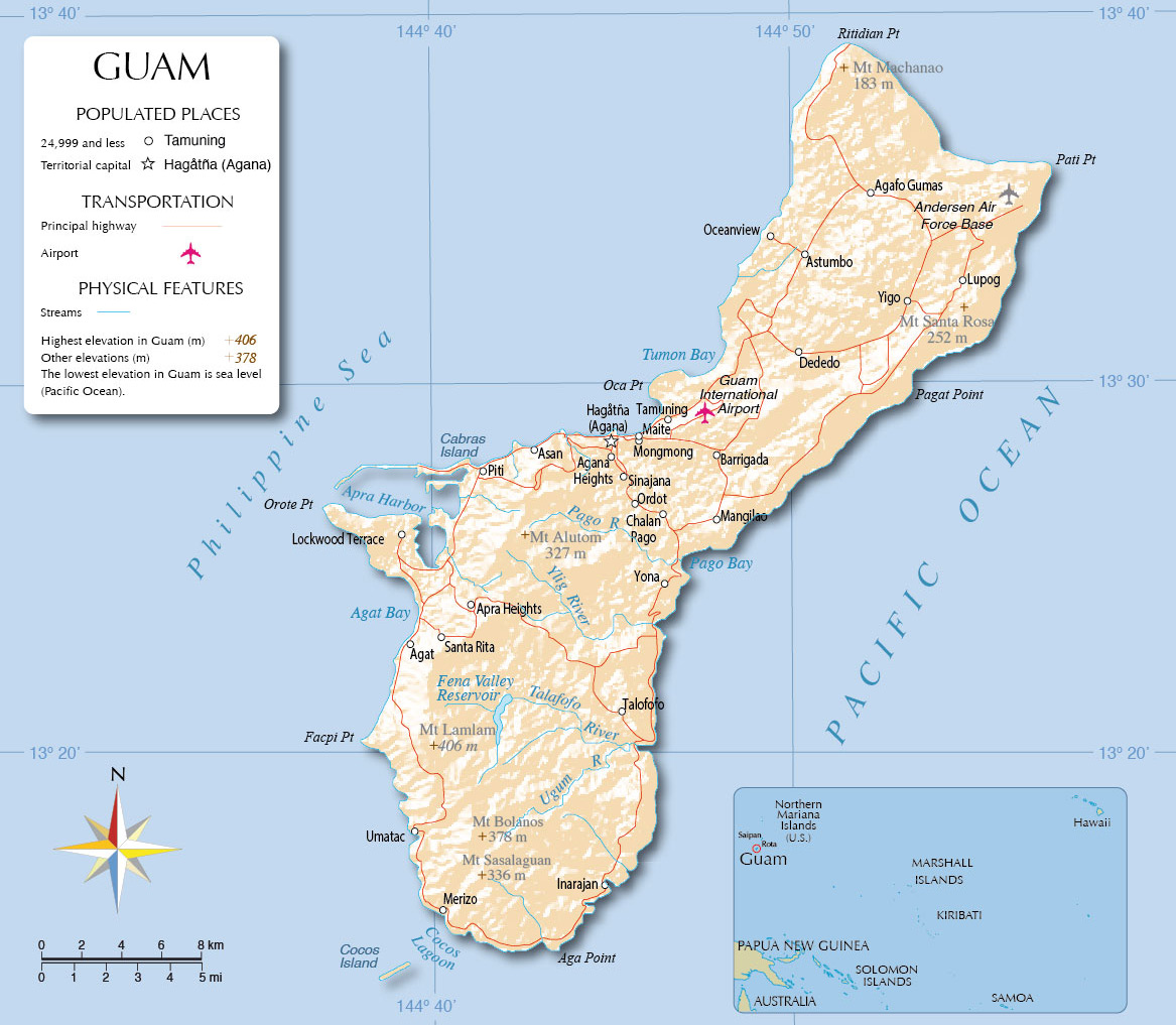
Guam
Guam is the southernmost island in the Marianas archipelago and is the largest of the more than 2,000 islands in vast Micronesia. The Chamorro/Chamoru people first settled the island roughly 3,500 years ago, and today Guam is the most populated of the Mariana Islands. Guam is politically recognized as a US Territory and its capital is Hagåtña.
The indigenous Chamorro people make up the largest social-cultural group, comprising about half of the population, although many ethnic groups live on the island. The districts and villages of the central and northern areas of Guam have the largest populations, while settlements in the southern half of Guam are mostly coastal and generally considered rural. There are 19 villages on the island and most are known by both their indigenous Chamorro and Americanized/ Spanish spellings — for example, Malesso’ is the indigenous name for Merizo.
Family, church, and politics are all important elements in Chamorro society, which emphasizes the collective good over individualism. The concept inafa’ maolek (pronounced e-na-fah mao-lek) is a central value of the Chamorro people loosely described as restoring harmony or order in the spirit of cooperation. Modern day reference to the phrase inafa’ maolek is now associated with a group of young adults who promote conflict resolution.
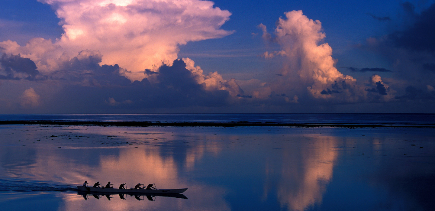
The rich and complex traditions of the Chamorro include their sailing prowess in proa (canoes). Traditionally, these canoes were the primary means of transportation between the Mariana Islands for trading, war, match-making, and recreation. The proa were nimble and quick, with some estimates putting them capable of speeds up to twenty miles per hour. Other descriptions liken the canoes to dolphins jumping from wave to wave and seeming to glide over the water, earning them the nickname “flying proa.” While almost lost to antiquity, a revival of canoe building and navigation has emerged within a younger generation of Chamorro studying under Polowatan navigators who still practice traditional seafaring. Today, there are classes, projects, and groups aiming to revive the proud seafaring traditions in Guam and the Marianas.
• Guampedia
https://www.guampedia.com/
https://www.guampedia.com/micronesia-portal/#Guam
Guampedia is a community project that highlights the unique Chamorro heritage and history of Guam and the Mariana Islands. They are a non-profit affiliate of the University of Guam, and in the Micronesia Portal, they provide general information about Guam as well as resources for further reading.
https://www.smithsonianmag.com/smithsonian-institution/brief-500-year-history-guam-180964508/
This article, published in the Smithsonian magazine, is a brief overview of a longer community study shared in Pacific Worlds, which includes important themes, maps, photos, illustrations, and a link to the entire study.
https://www.visitguam.com/about-guam/villages/
This webpage provides general info on 19 villages of Guam.
https://www.youtube.com/watch?v=udMofnjvaMY
A 2-minute video featuring traditional Chamorro dance.
https://www.nihiguam.org/programs
Guam’s first culture-based children’s program seeks to affirm identity and reconnect children and their families to their cultural and natural heritage (land and ocean) through fun songs, skits, stories, chant, and movement.
Homepage: https://www.uog.edu/
CHamoru Studies Program: https://catalog.uog.edu/current/programs/college-of-liberal-arts-and-social-sciences/chamoru-studies
Center for Island Sustainability: https://www.uog.edu/center-for-island-sustainability/
Guam Ecosystems Collaboratorium for Corals and Oceans (EPSCOR): https://guamepscor.uog.edu/about-guam-epscor/
Micronesian Area Research Center (MARC): https://www.uog.edu/marc/
The University of Guam is a center for post-high education for the Micronesian region, offering 34 undergraduate and 11 masters degrees and supporting research and publications that focus on the western Pacific region.
Homepage: https://www.uog.edu/uogpress/index.php
2021 Catalogue: https://www.uog.edu/_resources/files/uogpress/UOGPress_2021Catalog_Web.pdf
The University of Guam Press publishes an array of academic and literary books and journals with a specific focus on the unique history, environment, peoples, cultures, and languages of the islands that make up the Western Pacific region. Explore these links to their homepage and 2021 Catalogue.
Homepage: https://www.kuam.com/
Podcast Network: https://www.kuam.com/story/41617645/kuam-podcast-network
YouTube Page: https://www.youtube.com/user/kuamnews/playlists?view=1&sort=dd&flow=grid
Broadcasting since 1954, KUAM (630 AM) was Guam’s first commercial radio station to air Chamorro music and talk radio. Today, the station offers a variety of programming such as news, Chamorro music, and podcasts, as well as a master class series which highlights the cultural heritage of Guam’s indigenous Chamorro culture.
Republic of Kiribati
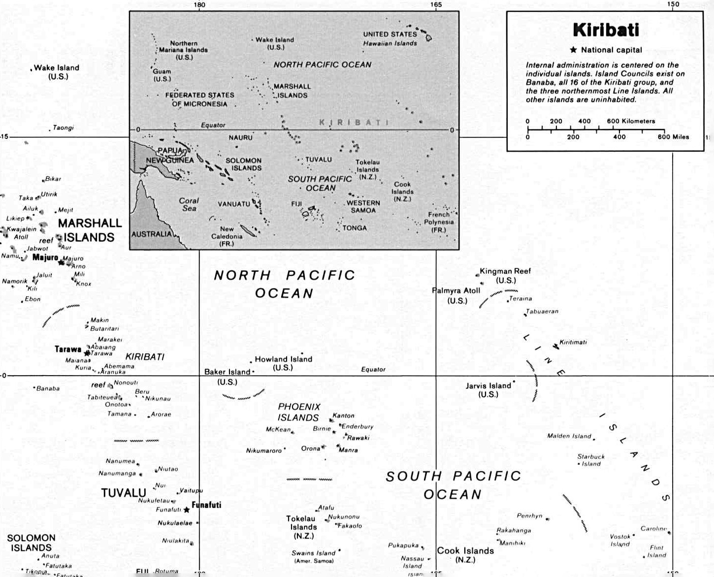
The Republic of Kiribati is made up of 32 atolls and one island grouped into two regions: the Gilbert Islands, and the Line and Phoenix Islands (the latter group combines the former Phoenix Islands and Line Islands). All of the atolls in Kiribati are situated near the equator and are low-lying, most rising only 6 to 7 feet above sea level. From east to west, the Republic of Kiribati spans some 2,400 miles which is nearly the same distance between the east and west coasts of the continental United States. It is also the only country in the world situated in all four hemispheres. Its capital is located on Tarawa in the Gilbert Islands.
The indigenous people of Kiribati, known as I-Kiribati, are the descendants of Austronesian-speaking voyagers who likely migrated from the Solomons-Vanuatu region some 2,000 years ago. In the 14th century, a wave of migrants from Sāmoa, Tonga, and Fiji settled in Kiribati leaving a strong Polynesian language and cultural imprint that is present today. Tungaru is thought to be the indigenous name for the Gilbert Islands, but Kiribati was chosen as the official name (encompassing also the Phoenix and Line Island group) when it became an independent republic in 1979. While both Kiribati and English are official languages, there are some areas where only Kiribati is spoken.
The family is a central part of society, and at the center of community life is the maneaba (meeting house). Strict traditions inform maneaba construction, seating arrangements, and members’ duties, and every village, most churches, and even some family groups have a maneaba where special occasions are celebrated. Large families are highly valued, with the oldest male heading the household. I-Kiribati typically live in extended families and relatives often adopt the children of other family members. Elders are treated with respect, and authority throughout the islands rests with the unimwane (council of elders) that is responsible for decision-making in each village.
Kiribati has also been at the center of the global climate change crisis.
Along with a handful of other atoll nations, it is counted as one of the world’s most vulnerable nations susceptible to loss of homes, cultures, and communities due to rising sea levels, increased threat of natural disasters, and other factors. In 2014, then-President Anote Tong led the effort to purchase land in Fiji as a potential new homeland for all residents who expected to be displaced. Since then, current president Taneti Maamau has rejected migration as a strategy, arguing studies have shown the islands can survive with the right adaptation measures, and the people of Kiribati will not be forced to leave. The health of Kiribati’s surrounding reefs will be a large factor in what happens to the ecology of the Kiribati in the future.
• Guampedia
https://www.guampedia.com/micronesia-portal/#Kiribati
Guampedia is a non-profit affiliate of the University of Guam, and in this Micronesia Portal, it provides general information about the island nations of Micronesia as well as resources for further reading.
https://www.youtube.com/watch?v=hW9EAkqu6aY
Supported by the UN Office for Disaster Risk Reduction, this 4-minute video explores the threat climate change and rising sea levels pose to Kiribati.
https://www.hrw.org/news/2018/06/15/interview-climate-change-and-disappearing-islands-kiribati#
An interview with filmmaker Matthieu Rytz who produced “Anote’s Ark,” a film which tells the story of Kiribati through the eyes of its former president, Anote Tong.
https://www.kiribatitourism.gov.ki/islands-to-explore/
https://www.kiribatitourism.gov.ki/kiribati-experiences/culture-island-explore/
This website provides a general overview of Kiribati, including an interactive map with island overviews and information on the culture and language of its people.
https://whc.unesco.org/en/list/1325
Learn more about this UNESCO World Heritage Site, which is the largest designated Marine Protected Area in the world.
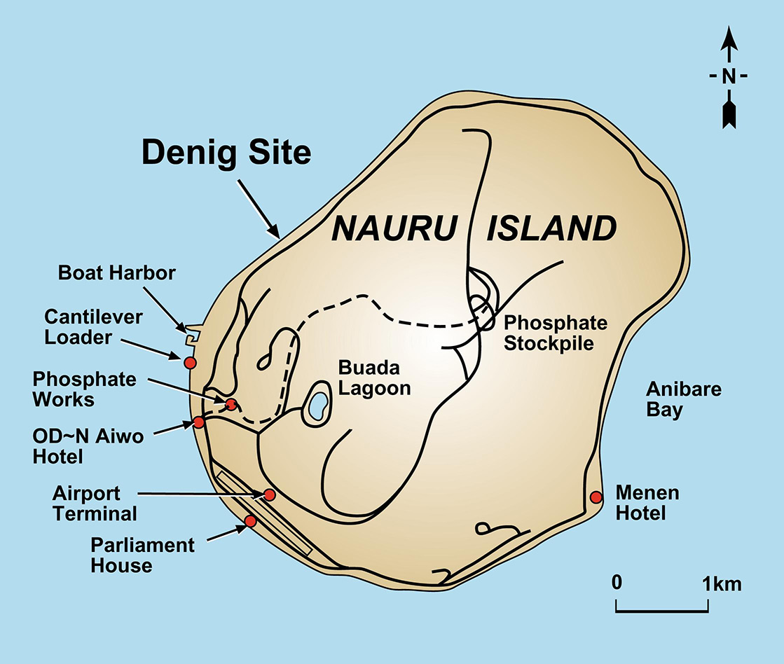
Republic of Nauru
The Republic of Nauru is the world’s smallest independent republic, totaling roughly 11 miles in circumference. Nauru was settled some 3,000 years ago by Pacific peoples, likely from Micronesia and Polynesia. Traditional society was organized into 12 matrilineal clans which the Nauruan people still belong to today, each clan with its own leader. Aquaculture and farming provided a sustainable way of life for Nauruans, and the highly valued indigenous hardwood tree, tomano, was an important resource.
The Nauruan language is widely spoken, although most Nauruans also speak English. Nauruans have a unique way of expressing direction, reflecting their island worldview and way of life. The four main directions are pago (coast), poe (edge of inner tree line), pawa (western quadrant) and pwiju / pwijiuw (eastern quadrant), while the term gankoro means “traverse the east side” and the term arijeijen means “traverse the west side.”
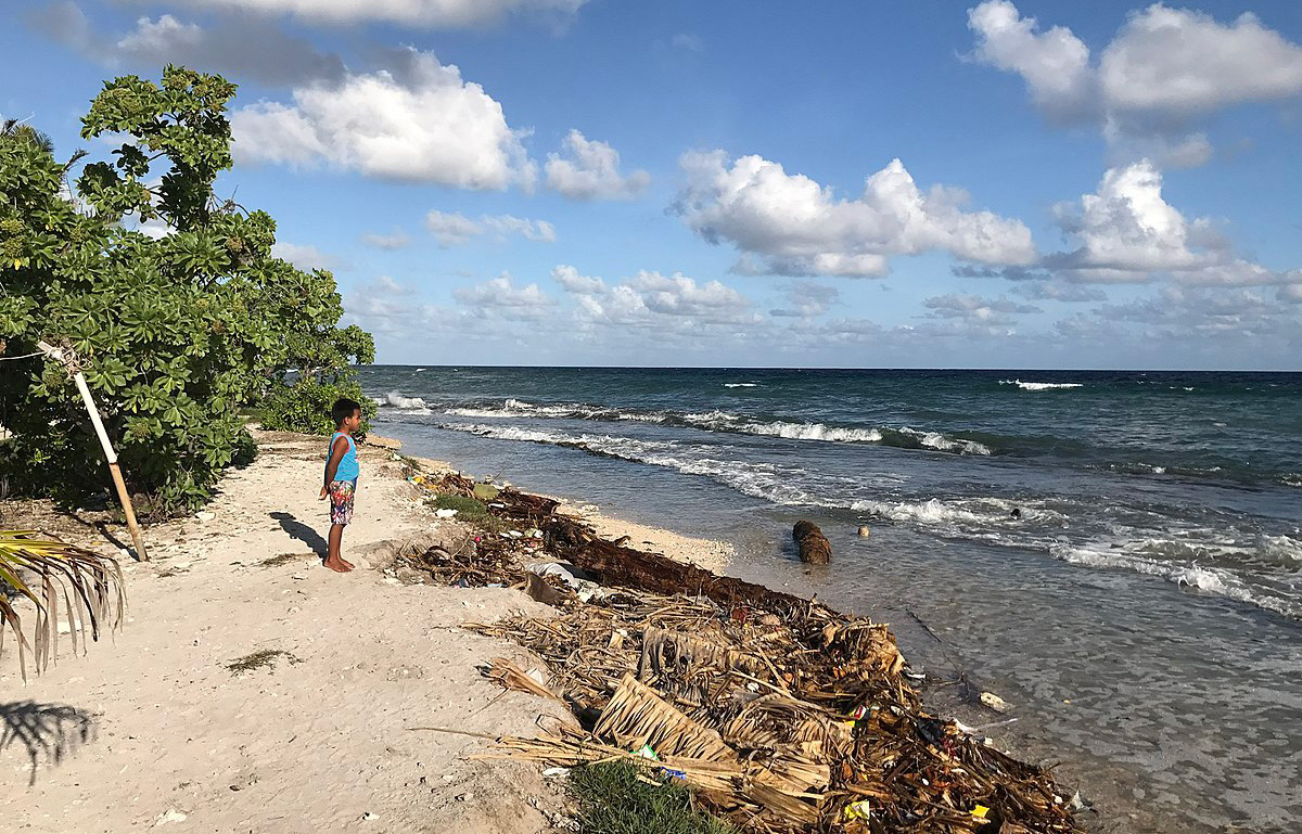
After a history of colonial powers controlling Nauru, phosphate mining emerged in the 1900s as a cornerstone of the economy, but sadly left much of the land degraded and unsuited for other purposes.
Today, the indigenous flora and vegetation of Nauru are among the most limited in the world, but efforts are being made towards environmental rehabilitation and sustainable development. Nauru’s Biodiversity Strategy and Action Plan recently recognized that although indigenous Nauru culture, tied to the land and the surrounding sea, has suffered great loss along with the rainforest and the reef, it is the rehabilitation of the land by and for the Nauruans that will restore and define Nauruan culture into the future.
• Guampedia
https://www.guampedia.com/micronesia-portal/#Republic_of_Nauru
Guampedia is a non-profit affiliate of the University of Guam, and in this Micronesia Portal, it provides general information about the island nations of Micronesia as well as resources for further reading.
http://naurugov.nr/about-nauru.aspx
The official website of the Government of Nauru provides a variety of geographic, demographic, and cultural information.
https://www.youtube.com/watch?v=J_o5EAvUyvQ
An 8-minute video featuring traditional dance performances of Nauru at the 2016 Festival of Pacific Arts held in Guam.
https://www.facebook.com/naurumedianews/
The official Facebook page of Nauru Media.
https://omniglot.com/writing/nauruan.htm
This Omniglot webpage features the recognized regional language of Nauru, including a sample of the language and background information.
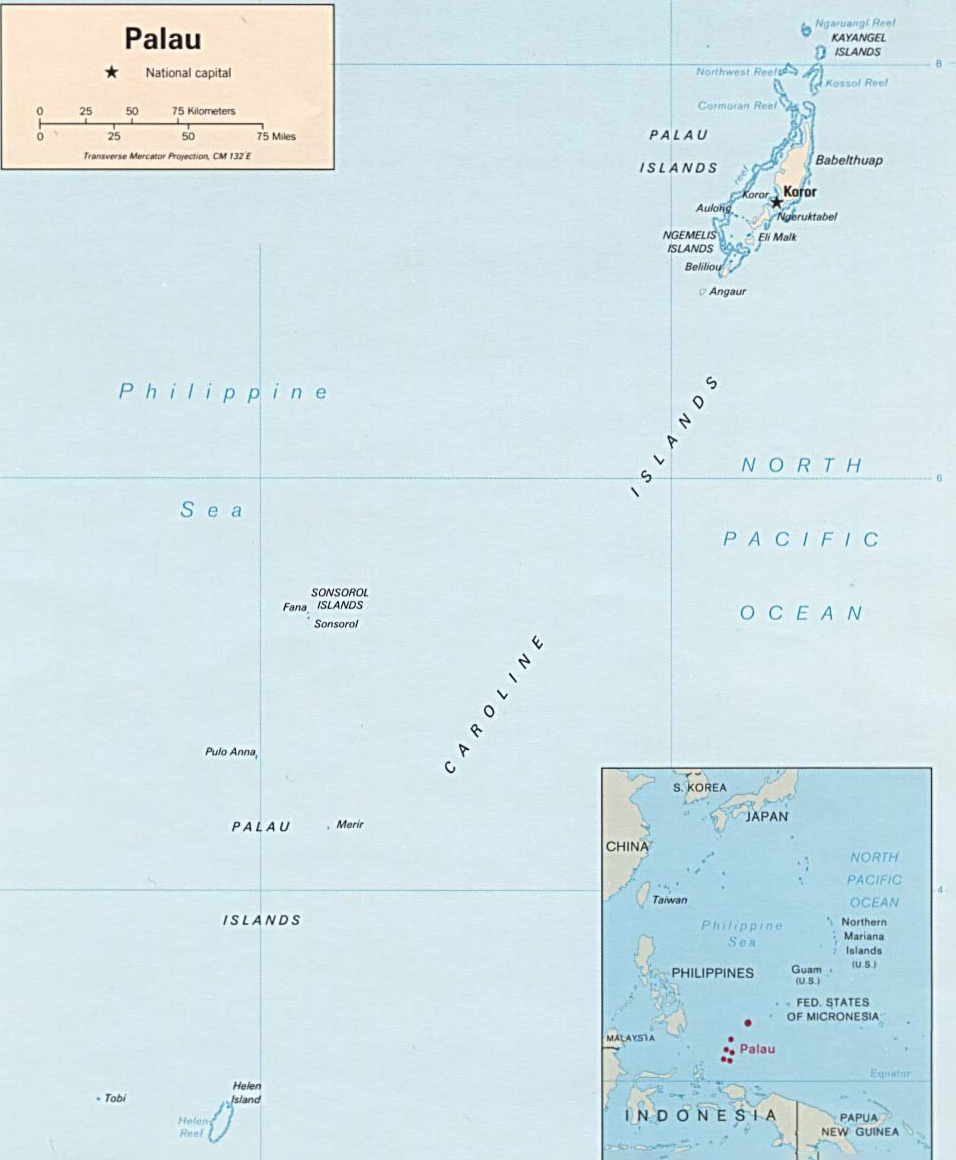
Republic of Palau
The archipelago of Palau is located in the Caroline Islands on the western edge of Micronesia. Palau was first settled by Austronesian speakers between 3000–3500 years ago, from Island Southeast Asia, likely the Philippines. It consists of some 340 islands that are organized into 16 states, with the majority of the population living on Angaur, Babeldaob, Koror, and Peleliu. The capital city, Ngerulmud, is in Melekeok State on Babeldaob, the largest island.
The indigenous people are referred to as Palauans, and while Palauan and English are the official languages, it is Palauan that is widely spoken in the communities, and most Palauans are bilingual from an early age.
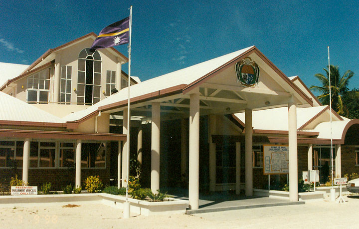
Palau adopted its own constitutional government in 1981 and was recognized by the United Nations in 1994 as an independent nation. While Palau has adopted a democratic constitution, The Rubekul Belau (council of traditional chiefs) advises the President on traditional matters. The Mechesil Belau (association of traditional matriarchs), which is the counterpart of the council of traditional chiefs, holds an annual conference addressing issues of culture, custom and modernization. The 16 states elect their own governors and state legislators, and traditional chiefs are very much a part of the leadership system.
Palauan villages are organized around 10 matrilineal clans. A council of chiefs composed of men from the 10 ranking clans governs each village, and a parallel body for women has a significant role in the division and control of land and money. While Palau is predominantly a Christian society, Modekngei (a traditional religion) is still widely practiced. Respect for others is important, and both men and women recognize people older than they are, while older people recognize youth for showing respect.
Known for its spectacular 70-mile-long barrier reef and the Rock Islands, which was named a UNESCO World Heritage Site, Palau is also known for it progressive environmental stance that is based in indigenous understandings of the natural world. The bul, a traditional moratorium on taking and harvesting resources, is still practiced today.
• Guampedia
https://www.guampedia.com/micronesia-portal/#Republic_of_Palau
Guampedia is a non-profit affiliate of the University of Guam, and in this Micronesia Portal, it provides general information about the island nations of Micronesia as well as resources for further reading.
This website, sponsored by the Palau Visitors Bureau, features a short video with a call to action regarding environmental protection. The pledge was written by children from all over Palau and shared with businesses that are encouraged to join their cause.
https://www.youtube.com/watch?v=SgdjrMynhdU
A 10-minute video featuring traditional dance performances of Palau at the 2016 Festival of Pacific Arts held in Guam.
https://www.palauconsulate.be/index.php/en/about-palau/culture
Information regarding traditional arts and culture in Palau, provided by the Consulate General of Palau in Belgium.
This site is part of the UN Environment project and highlights efforts to advance sustainable resource management to improve livelihood and protect biodiversity in Palau.
Created by the PEW Charitable Trusts, this fact sheet provides a high level overview of Palau’s National Marine Sanctuary.
https://whc.unesco.org/en/list/1386/
Learn more about this UNESCO World Heritage Site.
Republic of Marshall Islands
The Republic of the Marshall Islands is located near the equator and made up of 29 atolls and multiple islands and islets. First settled by Austronesian-speaking voyagers from the Vanuatu-Solomon Islands region some 2,000 years ago, the indigenous people called the leeward chain of atolls Rālik and the windward chain Ratak (the atoll groupings resemble two parallel lines running next to one another). The total area covered by the two chains is more than 750,000 square miles. The capital is Majuro on Majuro atoll, where about 31,000 people live.
The indigenous peoples are referred to as Marshallese. They have a clan-based, matrilineal society with land ownership passed down by women to their children and tying families together. Both Marshallese and English are official languages. Marshallese is used in daily life and government, while English is spoken widely in schools.
In addition to an elected legislature and president, the Marshallese have a 12-member traditional advisory council made up of iroij (traditional leaders), called the Council of Iroij (or council of chiefs). The council addresses custom and land issues. Marshallese land rights are governed by the jowi (clan). In traditional terms, the iroij (chiefs) have ownership of the land, while the alap (senior member of the clan) ensures the rijerbal (workers) are carrying out daily work on the land, including clearing, farming and construction.
After a history of occupation by different colonial powers, the Marshall Islands gained independence under a Compact of Free Association with the United States in 1986. Prior to that, however, the Marshall Islands were the site of nuclear testing by the US that would expose residents to nuclear fallout and leave long-lasting environmental destruction, health problems, and social challenges for the Marshallese people. Many of the former inhabitants of the affected atolls and their descendants are unable to return home, because their islands are contaminated with high levels of radiation, and many are awaiting claims from the US and the Nuclear Claims Tribunal.

Map of the Marshall Islands
[Downloadable pdf]
• Guampedia
https://www.guampedia.com/micronesia-portal/#Republic_of_the_Marshall_Islands
Guampedia is a non-profit affiliate of the University of Guam, and in this Micronesia Portal, it provides general information about the island nations of Micronesia as well as resources for further reading.
https://www.youtube.com/watch?v=ZB8s_Yqp3ko
This 12-minute video by PBS Newshour sheds light on some of the current challenges that are threatening life in the Marshall Islands.
http://mistories.org/index.php
The Marshall Islands Stories Project seeks to preserve the rich culture of the Marshall Islands by gathering life stories and traditional tales from Marshallese elders.
https://www.youtube.com/watch?v=5i41gwMShqk
A 28-minute video featuring traditional dance performances of the Marshall Islands at the 2016 Festival of Pacific Arts in Guam.
https://www.youtube.com/watch?v=VlRKxtyPOXs
A 3-minute video of creative expression in the fight against climate change.
http://www.rmiembassyus.org/index.php/about/marshall-islands/culture
This official Embassy website shares general information on culture, language, traditional practices, and other topics.
https://whc.unesco.org/en/list/1339
Learn more about this UNESCO World Heritage Site.
https://omniglot.com/writing/marshallese.php
This Omniglot webpage features the recognized regional language of the Marshall Islands, including a sample of the language and background information.
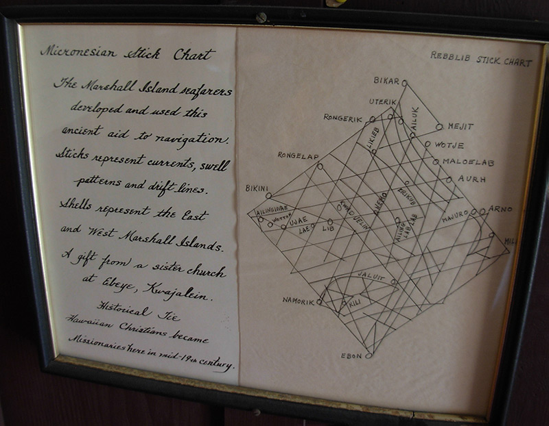
Micronesian Navigation: A Way of Life
Many areas of Micronesia retained the traditional knowledge of wayfinding as a part of daily life. However, this was not the case in the entire Pacific region. During the resurgence of indigenous culture and knowledge around the globe in the 1960s and 70s, the Polynesian Voyaging Society in Hawaiʻi built Hōkūleʻa, a Hawaiian voyaging canoe using traditional designs and modern materials. Pius “Mau” Piailug of Satawal began sharing his wayfinding knowledge with Hawaiians, leading to a renaissance of long-distance voyaging, canoe-building, and indigenous pride across Moananuiākea.
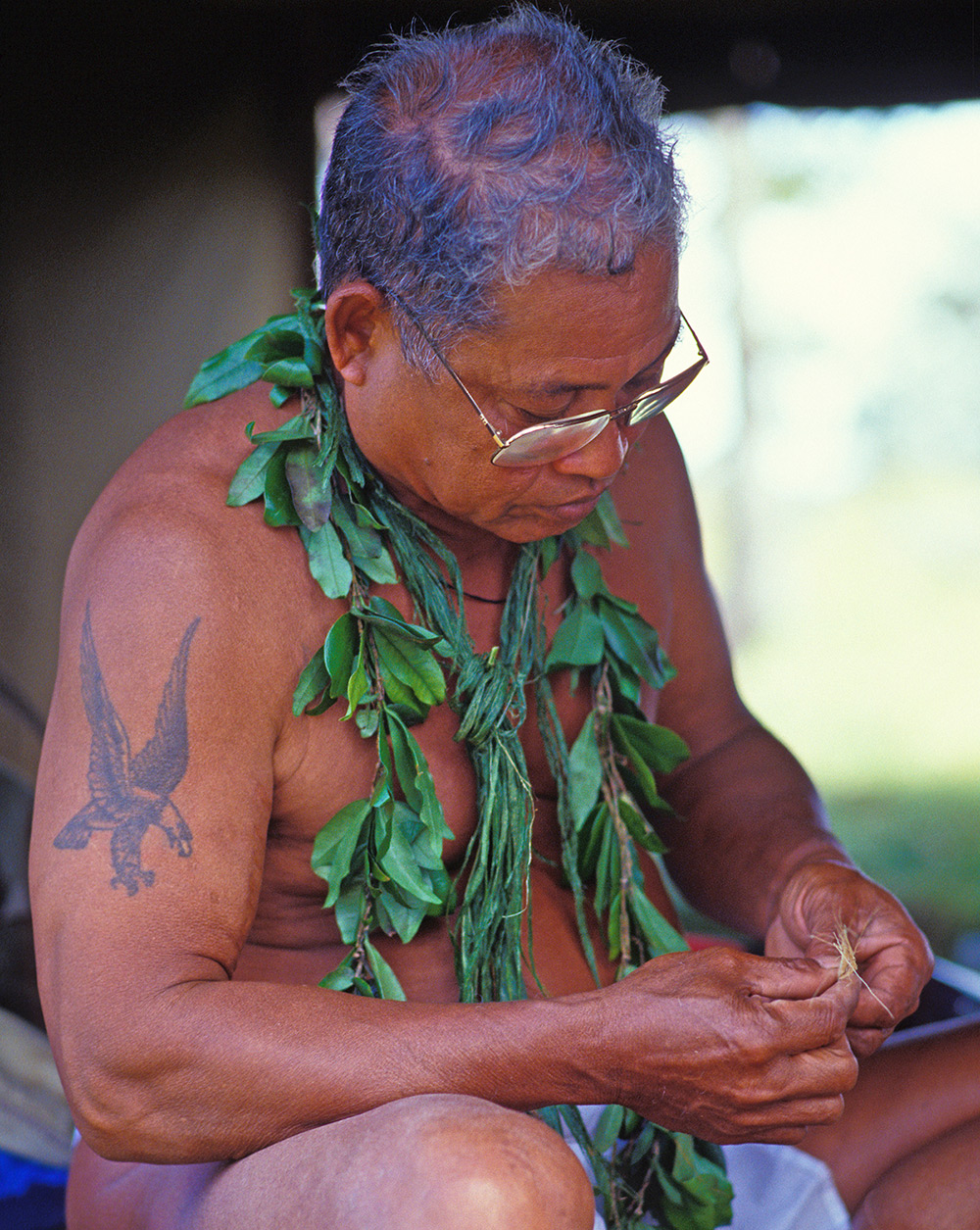
Pius “Mau” Piailug
Pius “Mau” Piailug (1932-2010) was born on the island of Satawal in the village of Weiso. His connection to the ocean began almost immediately after birth; he was placed as an infant into tidepools to experience the ebb and flow of the ocean. Chosen by his grandfather at the age of four to become an apprentice navigator, Pius spent his childhood learning about the stars and ocean swells, and finding direction from the winds and the flight patterns of birds. He continued his learning through to adulthood and at the age of 18, he was formally initiated as a Palu, master navigator, in the Weriyeng school of navigation. He was given the nickname “Mau,” derived from the Satawalese word “maumau” or strong. He came to be known for his bravery as he would sail in all types of weather. His courage and strength of character is reflected in his sharing of traditional wayfinding knowledge, which gave birth to modern non-instrumental navigation as we know it today.

In 1976, using traditional methods, Mau navigated the Hōkūleʻa on its maiden voyage from Hawaiʻi to Tahiti, demonstrating for the world what Pacific peoples had known all along — our Oceanic ancestors had profound knowledge and skills that enabled long distance voyaging with intention and precision for thousands of years. Papa Mau’s sharing of the wayfinding wisdom of his ancestors has helped to fuel cultural revitalization and pride in Hawaiʻi and throughout the Pacific.
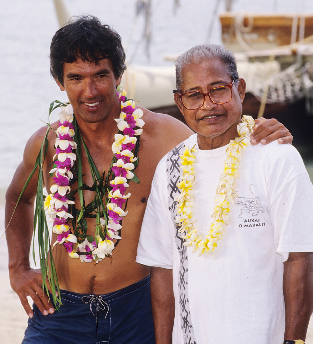
“I have laid the stick that connects people together. Now it is up to you, your generation and the generations to come, to build upon that stick a bridge that will ensure the free sharing of information and teaching between the two peoples until the day we become united again as a single people, as we were once before; before men separated us with their imaginary political boundaries of today’s Polynesia and Micronesia.”
~ Mau Piailug