PACIFIC MAPS
[Downloadable pdfs]
GREAT PACIFIC OCEAN
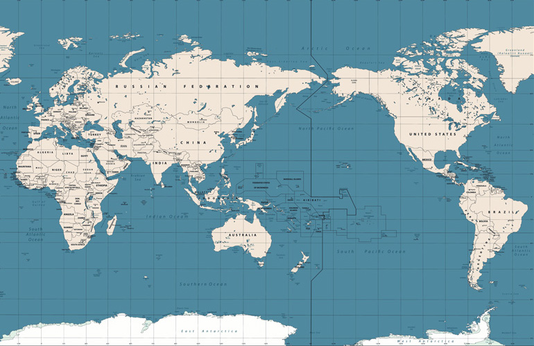
Pacific Centered World Map
[10.2MB pdf]
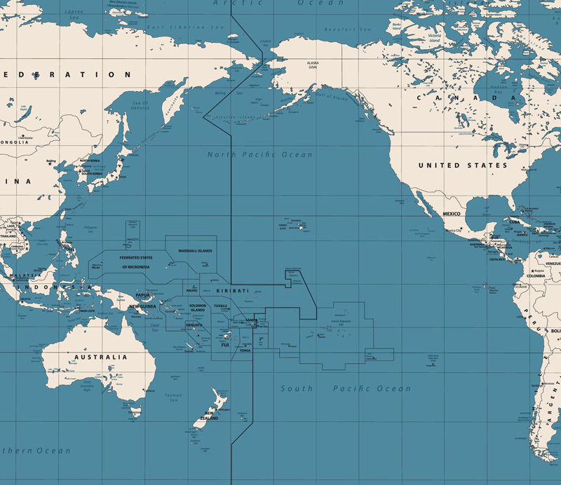
Pacific Basin Map
[7.4MB pdf]

Northern Pacific Ocean and Bering Sea
[1.1MB pdf]
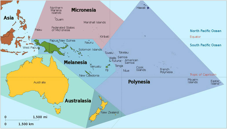
Oceania, Pacific Regions
(Tintazul, 2014)
[81KB pdf]
FRENCH POLYNESIA
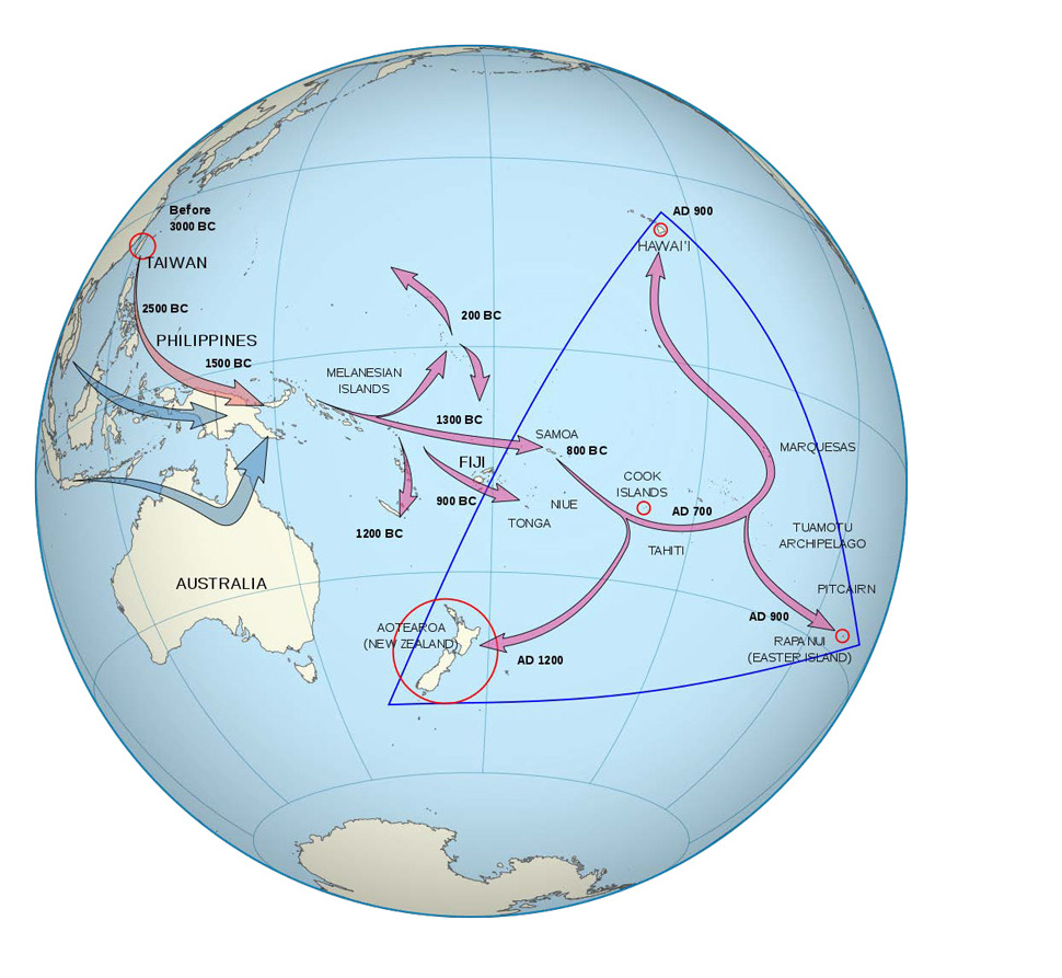
Pacific Migration and the Polynesian Triangle
(Eccles, 2008)
[122KB pdf]
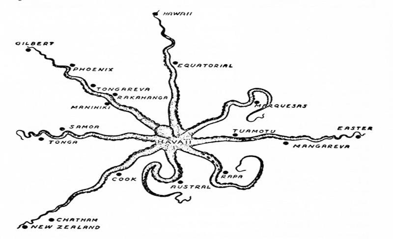
Havaiʻi (Raʻiātea) Centered Map with Octopus Motif: “Vikings of the Sunrise” (1938) by Dr. Peter H. Buck
(Te Rangi Hiroa)
[102KB pdf]
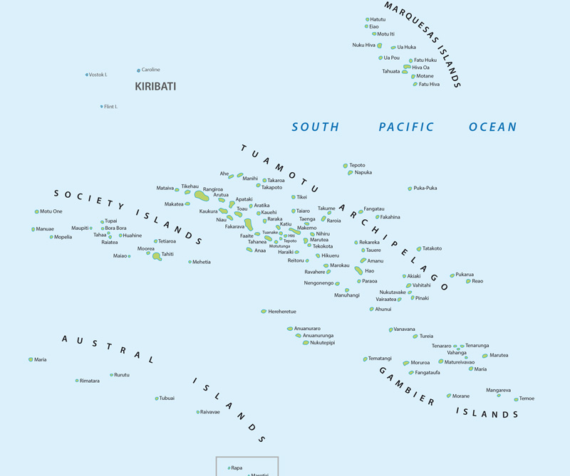
French Polynesia’s Five Island Groups & the Republic of Kiribati
[846KB pdf]
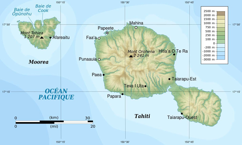
Tahiti and Moʻorea, French Polynesia
(Flaapiefh, 2013)
[89KB pdf]
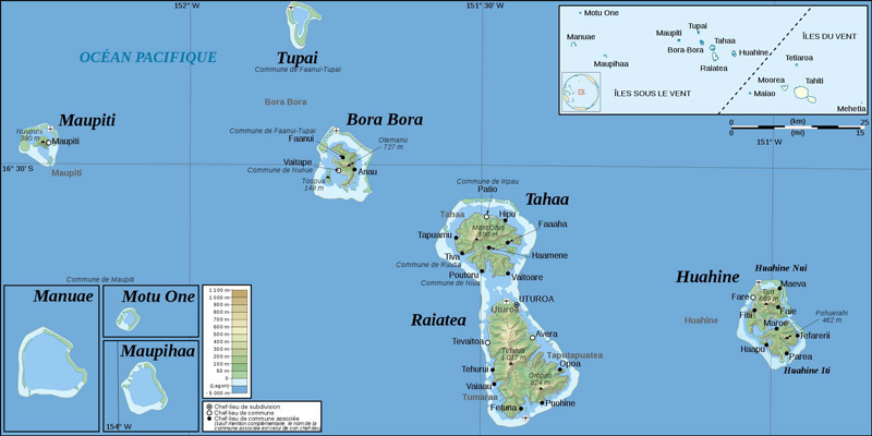
Leeward Islands, French Polynesia
[141KB pdf]
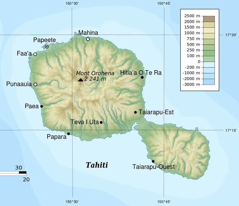
Tahiti, French Polynesia
(Flaapiefh, 2013)
[936KB pdf]

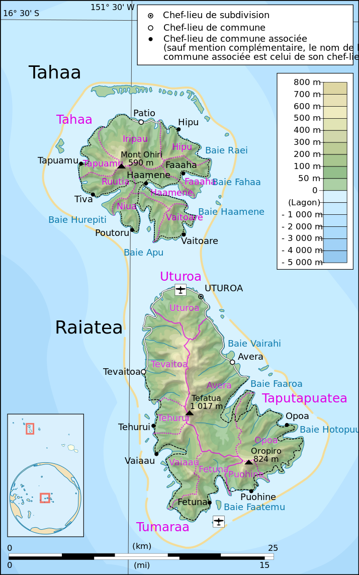
Tahaʻa and Raʻiātea, French Polynesia
[126KB pdf]
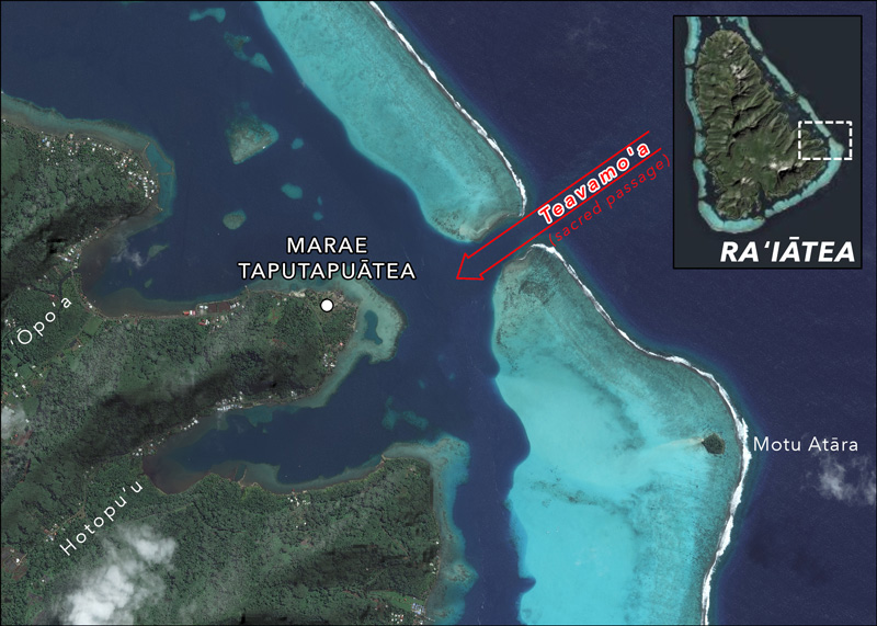
Taputapuātea & Teavamoʻa Pass, Raʻiātea
[6.6MB pdf]
AOTEAROA
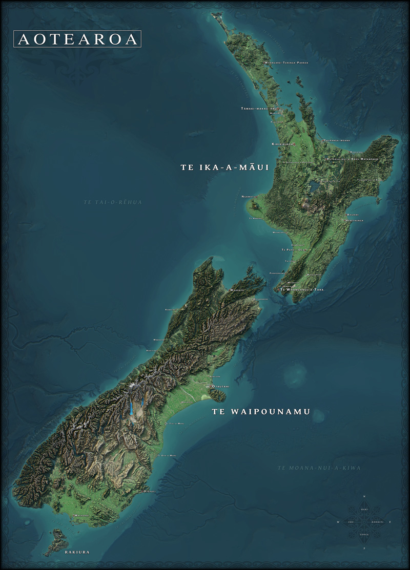
Aotearoa: Te Ika a Maui & Te Waipounamu
(Vality7, 2019)
[5MB pdf]
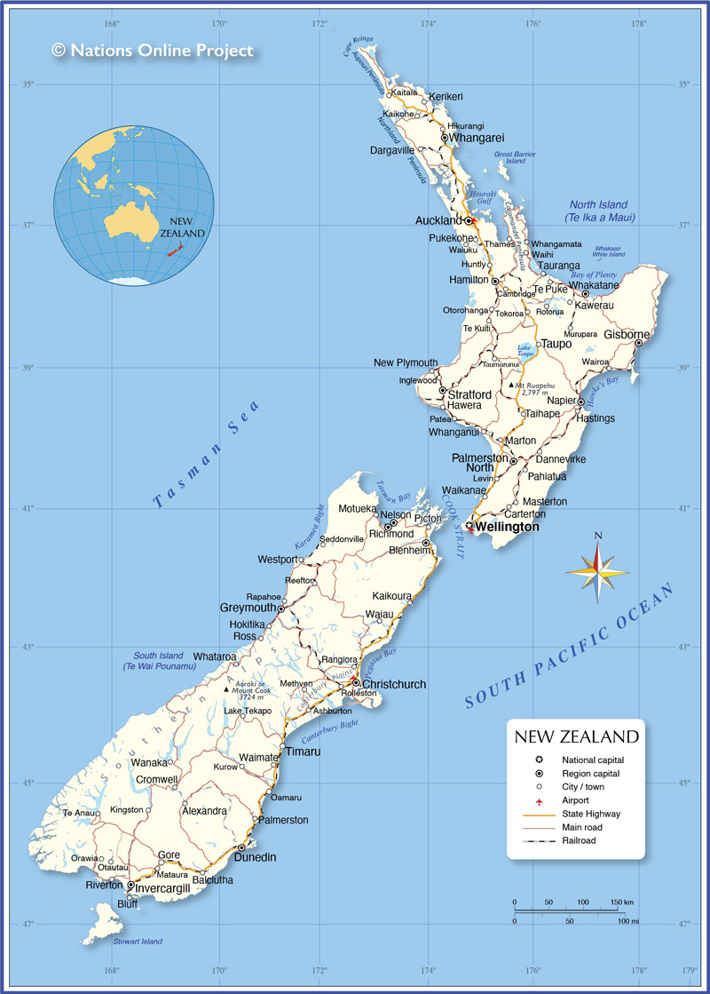
Aotearoa: North & South Island, NZ
(Nations Online, 2020)
[528KB pdf]
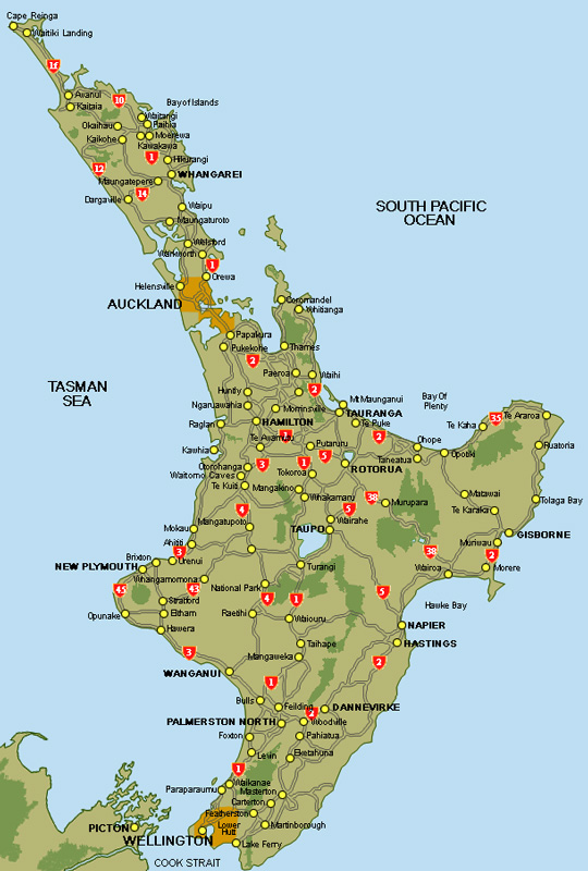
Te Ika a Maui, Aotearoa / North Island, NZ
(Backpack New Zealand, 2020)
[66KB pdf]
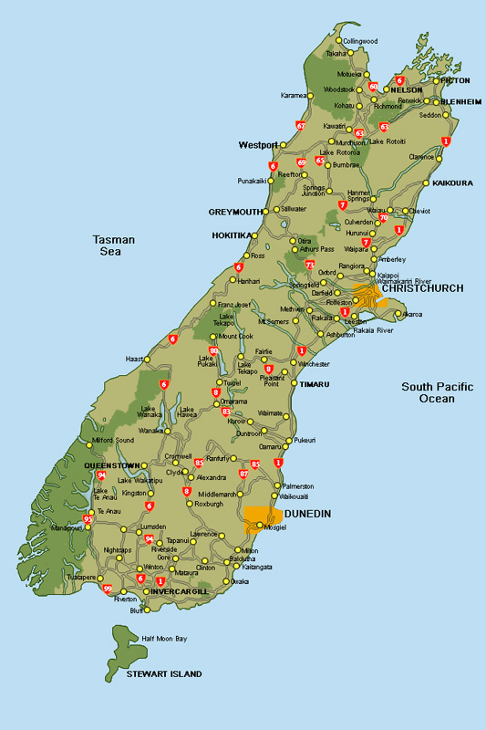
Te Waipounamu, Aotearoa / South Island, NZ
(Backpack New Zealand, 2020)
[63KB pdf]
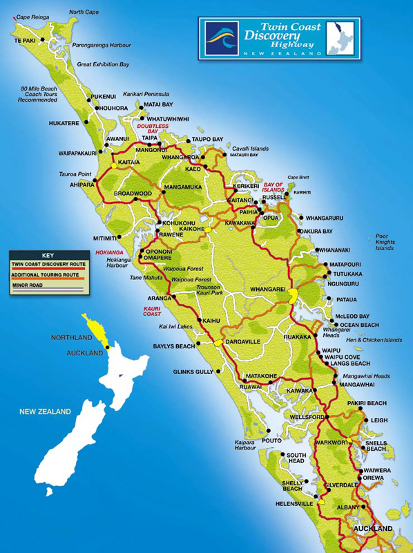
Te Tai Tokerau Major Highways, Aotearoa / Northland, NZ
(NZTA, 2016)
[137KB pdf]
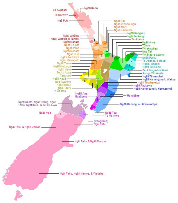
Māori Iwi (Tribes), North & South Island, Aotearoa NZ
[66KB pdf]
ALASKA
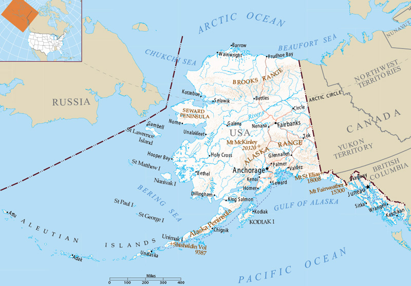
Alaska
(US Department of Interior, 2012)
[450KB pdf]
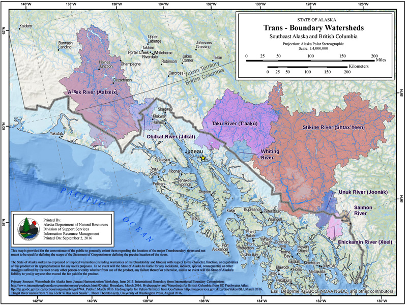
Watersheds in Southeast Alaska, US
(Alaska Department of Natural Resources, 2016)
[2.2MB pdf]
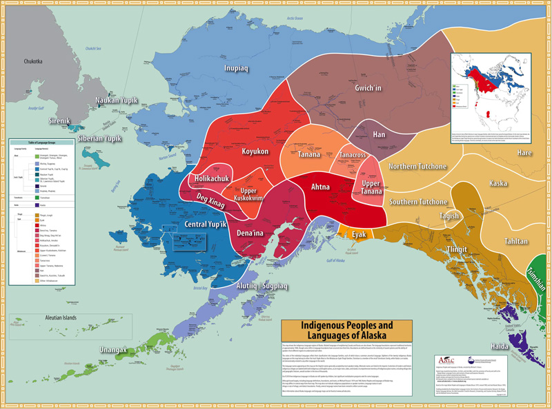
Alaska Natives and Languages
(Krauss et al. 2011)
[499KB pdf]
TAIWAN
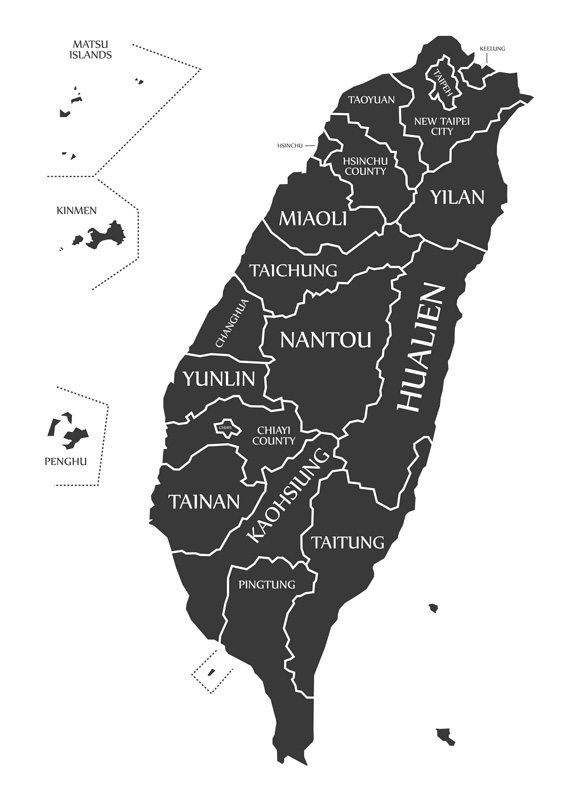
Taiwan Counties
[499KB pdf]
MICRONESIA

Map of Micronesia
[5MB pdf]
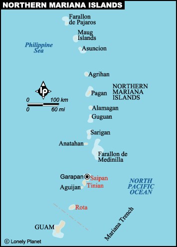
Map of the Northern Mariana Islands
[5MB pdf]
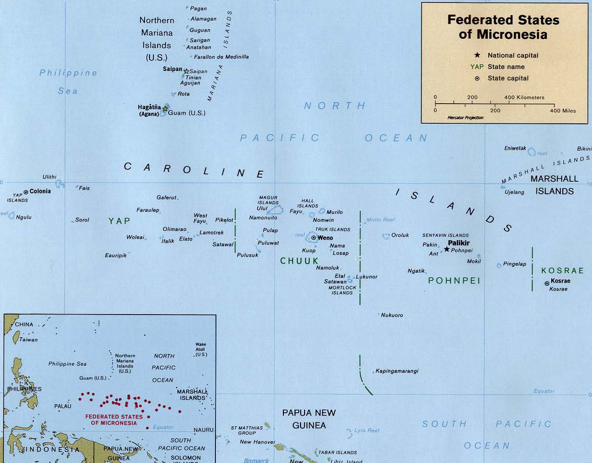
Map of the Federated States of Micronesia
[5MB pdf]
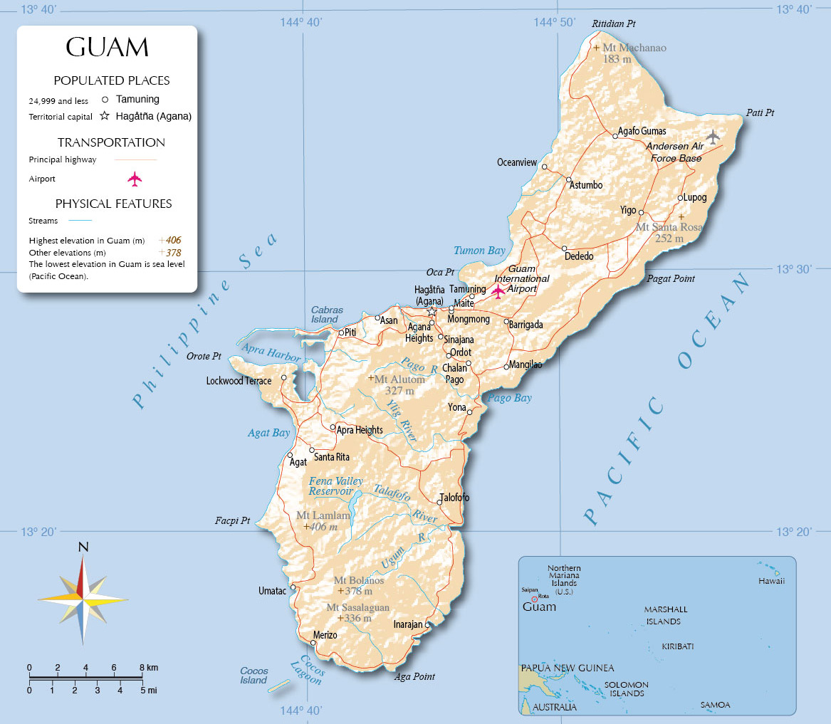
Map of Guam
[5MB pdf]
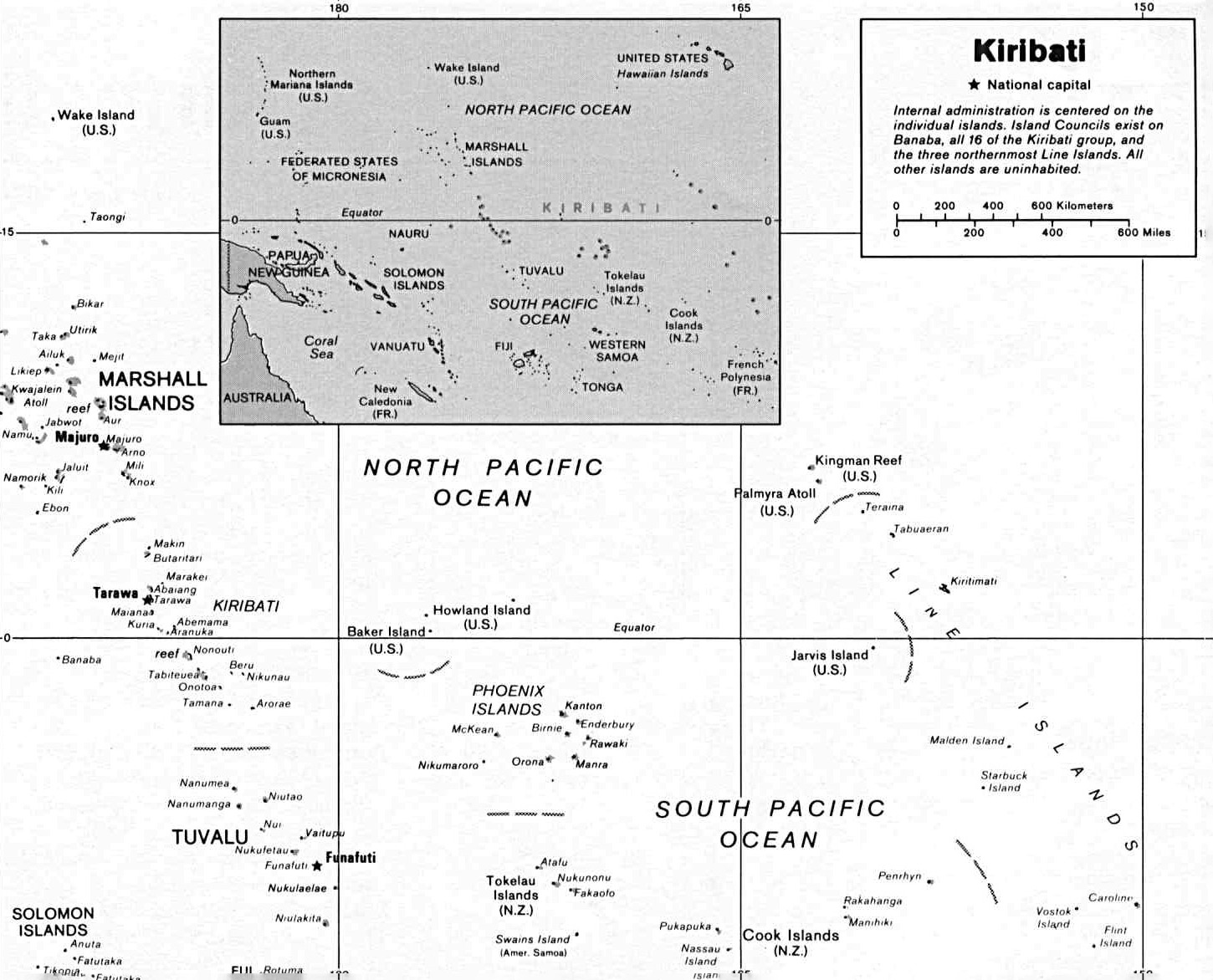
Map of Kiribati
[5MB pdf]
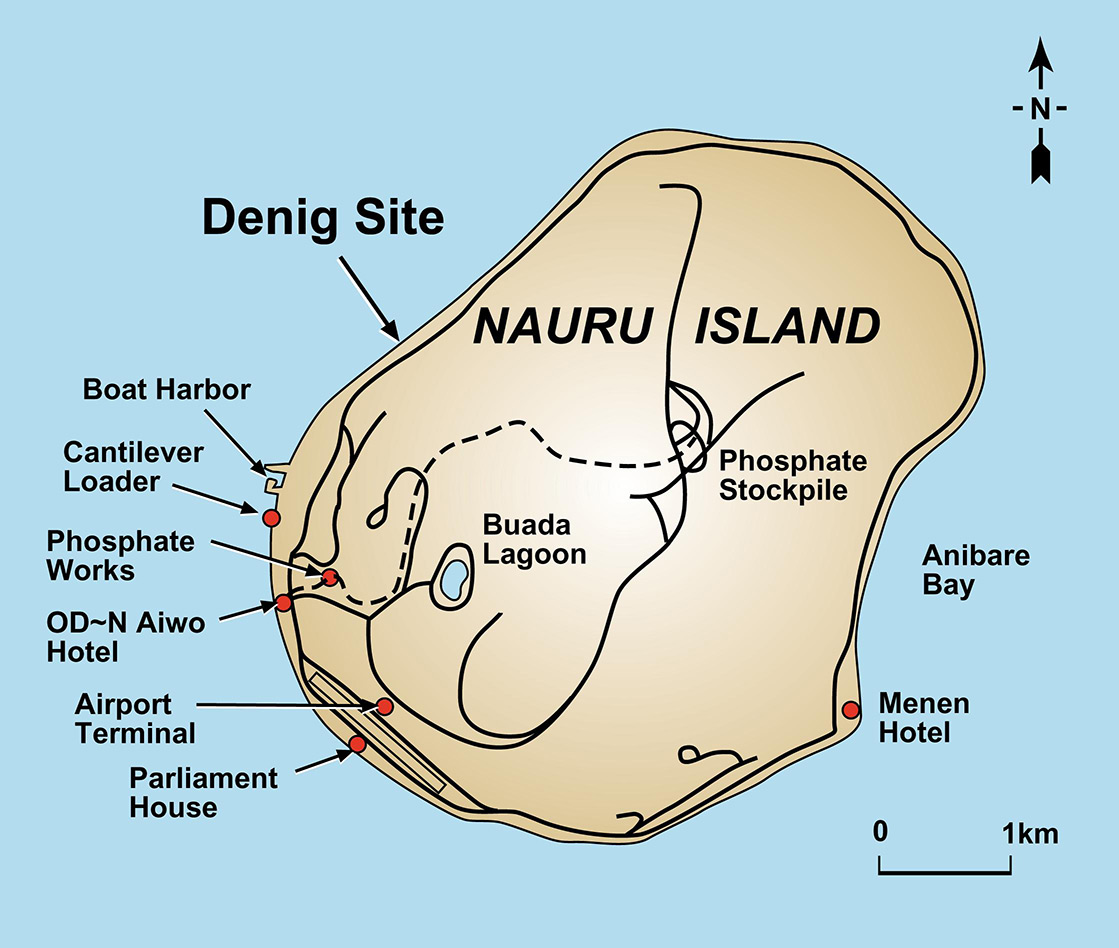
Map of Nauru
[5MB pdf]
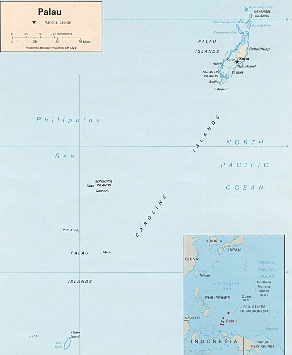
Map of Palau
[5MB pdf]

Map of the Marshall Islands
[5MB pdf]

Map of Satawal
[5MB pdf]
RAPA NUI
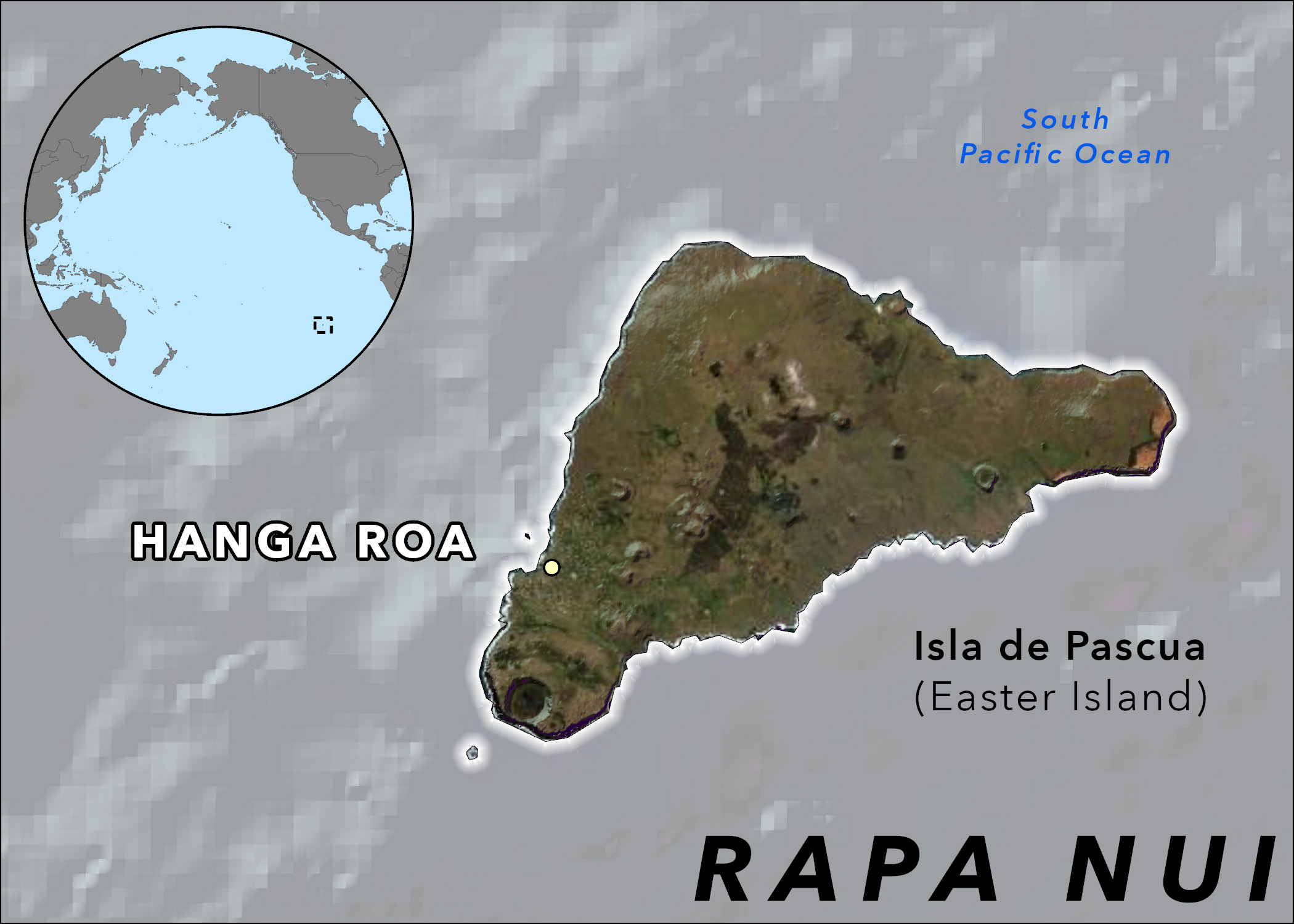
Map of Rapa Nui
[5MB pdf]