Digital Collections
Celebrating the breadth and depth of Hawaiian knowledge. Amplifying Pacific voices of resiliency and hope. Recording the wisdom of past and present to help shape our future.
Thomas K. Lalakea, Courtesy the Hawaiian Historical Society
In 1821, Otto von Kotzebue, a Russian naval officer wrote, "The taro fields excited my attention . . . I have seen whole mountains covered with such fields, through which water gradually flowed; each sluice formed a small cascade which ran . . . into the next pond, and afforded an extremely picturesque prospect."
Kotzebue was describing the ‘auwai, or irrigation ditch system, that supplied water from streams to flood the lo‘i kalo (taro fields.) Wetland kalo was the food staple for Hawai‘i. Extensive terraced fields and irrigation ‘auwai were created to grow the staple. Construction of irrigation ‘auwai was a communal undertaking. For example, the Pākī ‘auwai which was constructed to carry water from Luakaha, at the upper reaches of today’s Nu‘uanu Pali Drive, to lo‘i kalo below Wyllie Street utilized a work force of 700 men furnished by the chiefs and other landowners.
Water rights to an ‘auwai were based upon the number of men a landowner furnished to build the ‘auwai. More men resulted in more water rights, which would be applied to irrigate larger parcels of land. Only kalo was entitled to water from the ‘auwai. Dryland crops had no claim to ‘auwai water. Use of the water was regulated by time increments, which varied from a few hours each day for a small kalo patch to two or three days for a kalo plantation. By rotation with others on the ‘auwai, a grower would divert water from the ‘auwai into his kalo. The next, in turn, would draw off water for his allotted period of time.
Control of the ‘auwai and its users was directed by the chief holding the most rights to water usage. He was the luna wai, or water boss, who directed the cleaning and repair of the ‘auwai and rewarded or punished growers with increased or lessened rights to water usage according to their performance in tending the ‘auwai.
Today, the historic ‘auwai serve decorative purposes...as landscaped water ways, as small ponds with water lilies, and as display pools for carp. Such a segment of ‘auwai can be seen from the Kimo Drive bridge entering Dowsett Highlands.
For beautiful images of ‘auwai, including the Pākī ‘auwai which was constructed to carry water from Luakaha to lo‘i kalo below Wyllie Street, visit www.pacificworlds.com/nuuanu. They have personal stories, geographic information about wind, rain, the forest, and agriculture of Nu‘uanu, Kawaihae, and Hā‘ena, as well as bibliographies and links to external sites.
Visit the www.pacificworlds.com homepage for more information.
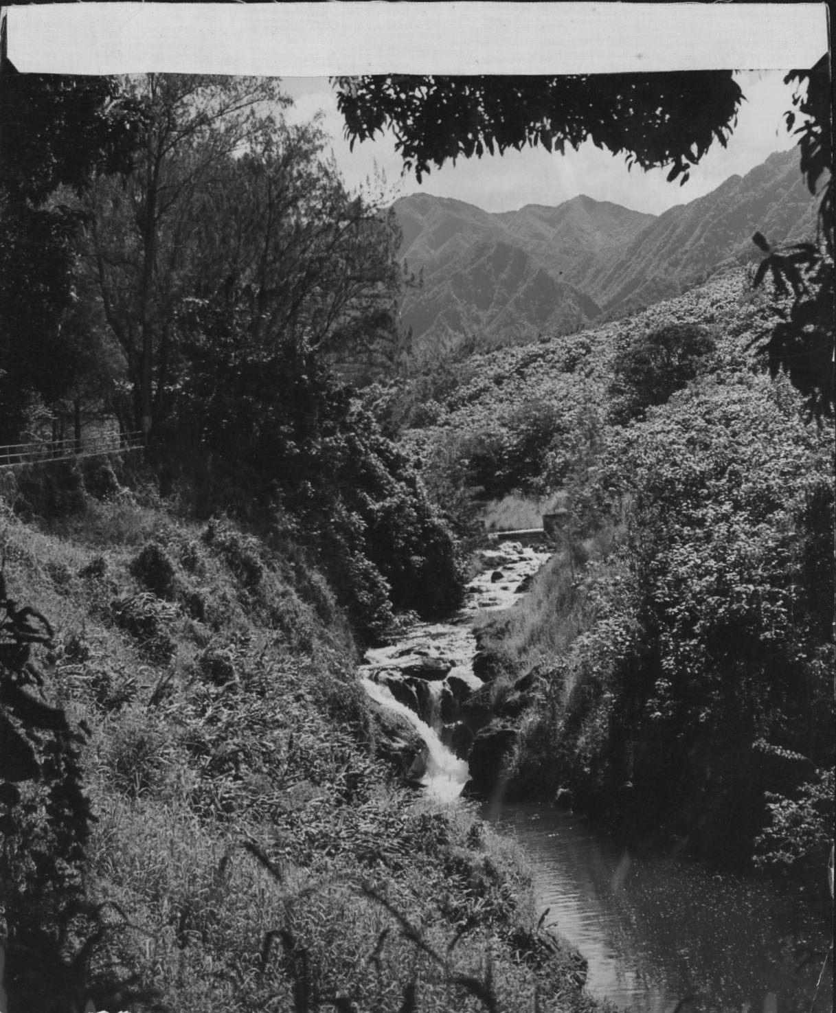
Photo Credit: Hawaiʻi State Archives
Nuʻuanu Valley and reservoir.
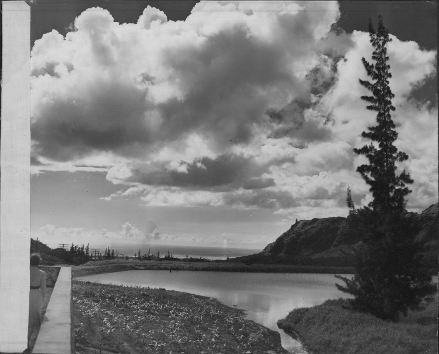
Photo Credit: Hawaiʻi State Archives
Reservoir.
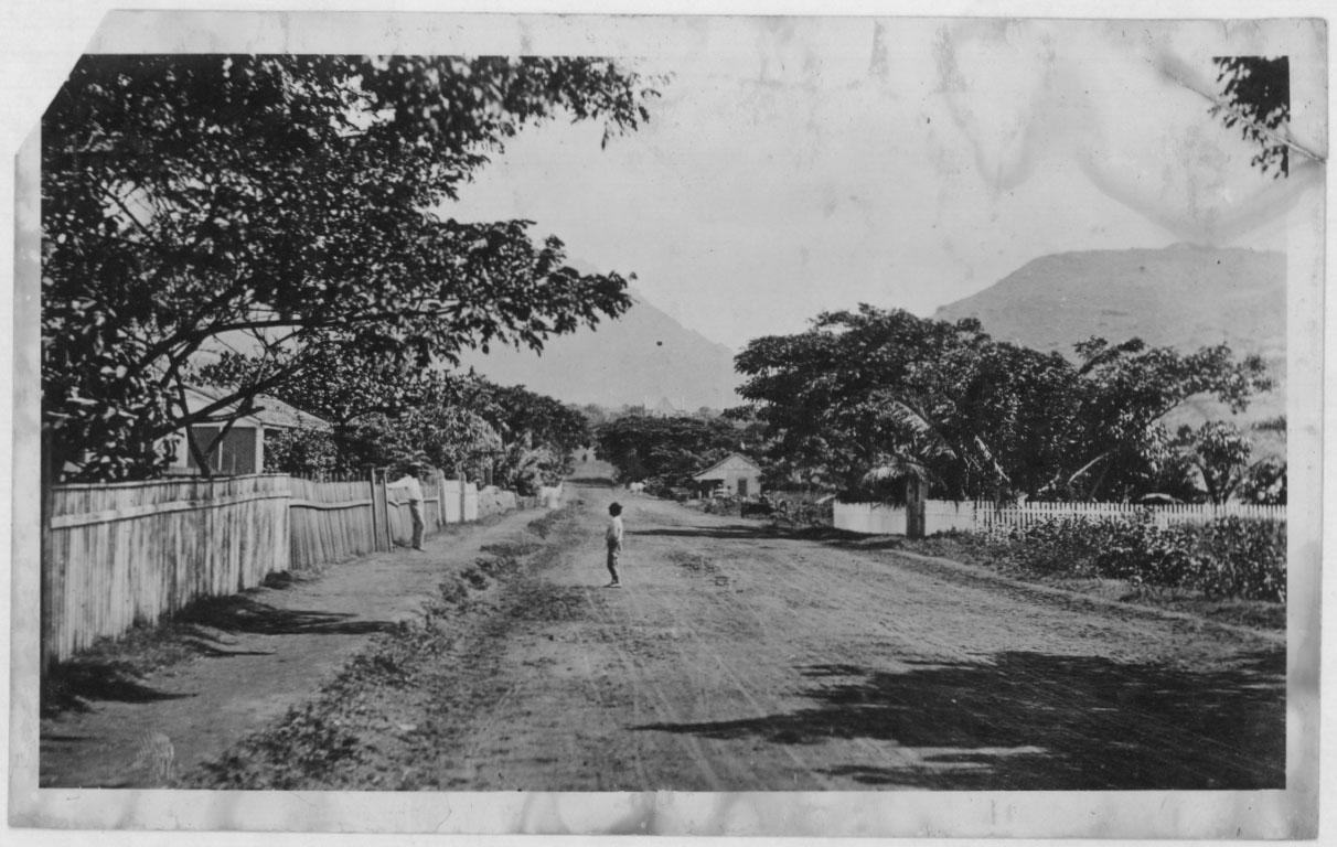
Photo Credit: Hawaiʻi State Archives
Nuʻuanu Avenue and ʻauwai.